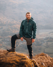
Scafell Pike Via The Corridor Route
About
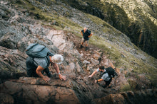
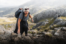
Scafell Pike stands as the tallest mountain in England at 978m (3,210ft) above sea level. Its height marks it as a bucket list summit for many to tick off, one of the national three peak summits, as well as being a Wainwright too. With many options of how to climb it, we have chosen to run this group, guided trip ascending up via the corridor route, summiting Scafell Pike, then continuing a circular route to return to where we started. This is an exciting, intermediate scramble up to the summit, with some interesting terrain to navigate and stunning views around the Lake District.
Key Facts
Route: Scafell Pike via the Corridor Route
Summit(s): Scafell Pike
Wainwright(s): Scafell Pike
Summit height: 978m (3,210ft)
Miles covered: 9.5miles (15km)
Elevation gained: 3,280ft (1,000m)
Difficulty: Intermediate
Start point: Seathwaite Farm, Borrowdale (exact location to be sent closer to the time)
Route type: Circular
About Us
Your hike will be guided by 2 experienced mountain leaders – Cara Edden & Joe Strudwick who both have a love of the great outdoors and an extensive knowledge of the area. Your safety is our number one priority and we’re here to ensure that not only do you have a great day out but are kept safe at all times.
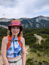
Hi, I’m Cara. Currently living in the midlands, I spend most of my free time driving between Wales and the Lake District to spend my time in the mountains. I am a qualified mountain leader guiding groups across mountainous terrain as well as conquering my own outdoor challenges. I am currently climbing all of the Welsh mountains, with my current total at 152/189 and have completed several other trails including The West Highland Way, Skye Trail and sections of The Jurassic Coast & The Cleveland Way.
Hey, I’m Joe. Originally from the South of England, I moved up north two years ago to be closer to the Lake District. I qualified as a mountain leader after starting the qualification with the army on a weeks hiking trip in Austria. In my free time I am completing a round of the Wainwrights, whilst also working on my RCI qualification and being a dog dad!
We look forward to seeing you on the hills!
What you will need:
Kit lists can vary depending on the weather predicted for the day. Below is a list of the essential kit you’ll need to carry for all weathers. Should anything change with the weather closer to the time, we will be in contact with an updated kit list. It is imperative that every member of the group has everything listed with them when we meet at the start point, if not, we won’t be able to guide you up the mountain. The weather can change quickly and so our main priority is ensuring the groups safety in the mountains, which is why keeping this basic kit list in your rucksack is so important.
A backpack large enough to fit the following items in
Waterproof cover for the backpack
Waterproof trousers
Waterproof jacket
A spare mid-layer (eg a fleece)
Warm hat & gloves
Head torch
Warm jacket
Lunch & snacks (enough to fuel yourself for a full day in the mountains)
Water (no less than 1.5 litres)
Personal medication
We advise you to arrive in suitable clothing ready to hike. This includes walking trousers or leggings (no jeans or joggers), if it is cold, a pair of thermal trousers underneath (merino wool is great). On top a base layer is great for the colder weather too (merino wool here is great again or sweat-wicking clothing), as well as a mid-layer (fleece). Suitable hiking or trail shoes are essential too (no trainers), so you have grip and comfort for the mountainous terrain.
If you have any questions regarding what is the best sort of clothing or are looking for advise on what to wear – please send us a message and we’ll be happy to help.
You will also need your own transport or to arrange for a way to get to the meet point at the start of the hike.
Common Questions:
What if there is bad weather?
We aim for every guided hike with at least one person booked on to go ahead. The only exception to this is if there is unprecedented weather which would make the hike dangerous. We appreciate you putting your trust in ourselves to keep you safe on this hike and so will be open and honest about elements such as the weather which will have an impact. We will be in contact the week before regarding weather forecasts, what to expect and if there are any other bits of kit to bring for your safety & comfort. Please read the T&Cs for more policy information regarding bad weather & cancellations.
How long will the route take?
The route on average should take between 7-9 hours. This can vary dependent on weather and group fitness. We will ensure the hike is a social event as well as a fun day in the outdoors, therefore the group will stay together for the entirety of the day so we can guide safely through the mountainous terrain and we can keep each other company with witty jokes and chit chat!
Will it be okay if I am scared of heights?
A fear of heights should never prevent you exploring the mountains, though some routes have more exposed paths and drops than others. If you are worried about how you will find the route, please contact us and we’re happy to advise on whether the hike would be suitable or we may be able to offer you a more enjoyable route with the same final outcome of an exciting day in the mountains!
How do the difficulty levels vary?
Beginner: A mainly well pathed route which isn’t technically challenging with less extreme elevation or drops, though still an exciting day out with plenty of views.
Intermediate: A mixture between pathed routes and some scrambling. There may be some exposed drops or edges at times and we’ll be climbing more elevation. The route will have physically challenging elements but we’ll be able to pause for breaks in between.
Difficult: More technical scrambling sections which may be exposed or have drops around them. The route will be physically challenging but very exciting. You’ll need a head for heights on this one!
What is the difference between a circular route, an out and back route and a liner route?
A circular route will start and finish in the same place but will head out and return on a different path to then join back and meet where we started. Whereas an out and back route will head out along one route and then return on the same one. A linear route then starts and finishes in different points so we will be moving in one direction then getting either a car, pre-arranged transport or public transport back to the start point.
By booking onto this guided hike, you are automatically agreeing to the terms and conditions which can be viewed here. (If the link doesn’t work, please type the following https://caraedden.com/pages/terms-of-service into your browser or contact us before booking.)
You will also need to complete the form emailed after booking to you regarding personal information to ensure your safety on the hike. This must be returned no later than 2 weeks before the hike.
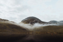
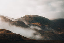
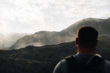
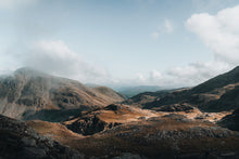
Photography by Joe Strudwick on the route we'll be taking.


